Global S&T Development Trend Analysis Platform of Resources and Environment
| PAZ Earth observation satellite successfully launched | |
| admin | |
| 2018-02-22 | |
| 发布年 | 2018 |
| 语种 | 英语 |
| 国家 | 德国 |
| 领域 | 地球科学 |
| 正文(英文) |
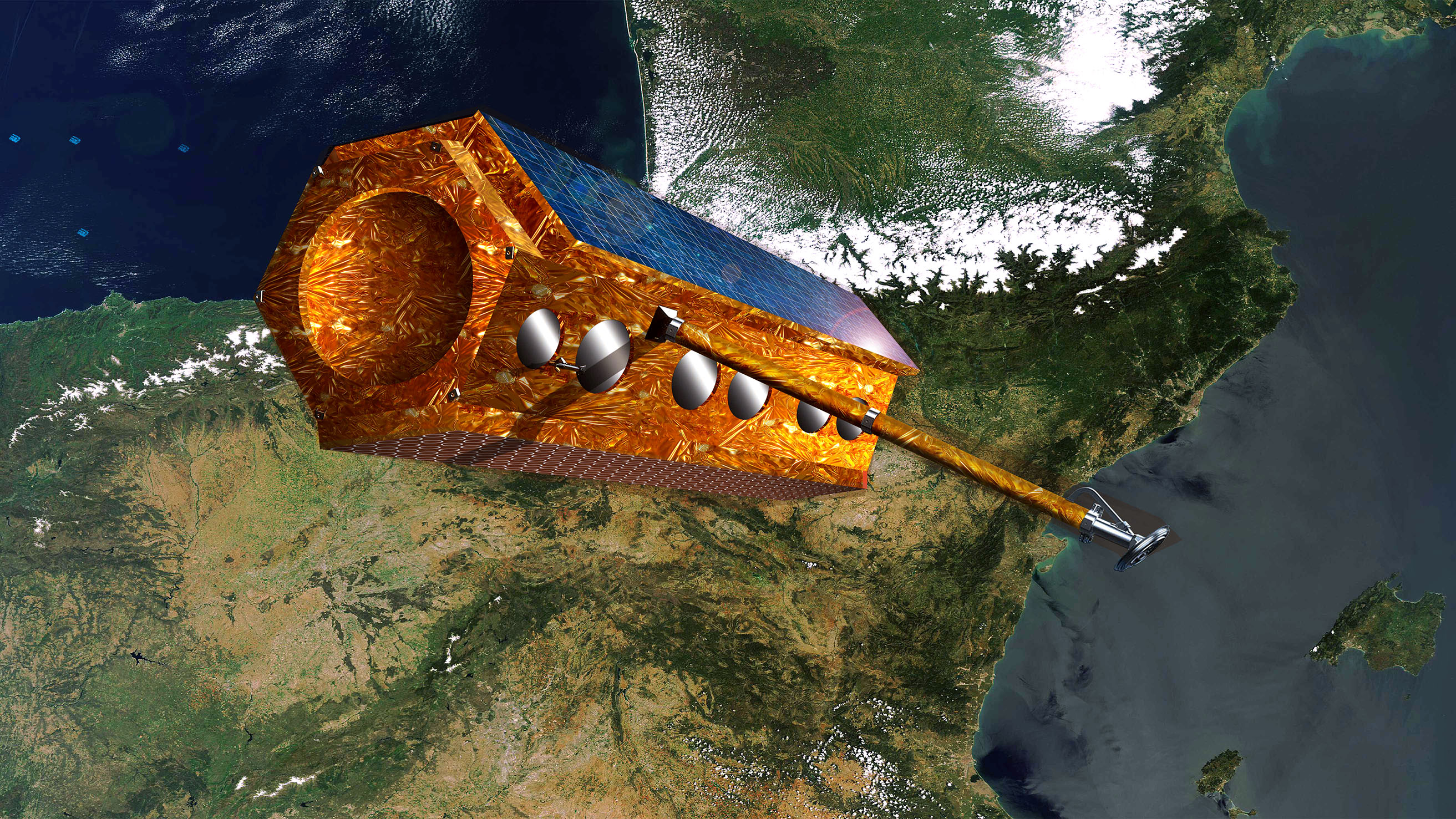
PAZ satellite in orbit: artist impression
PAZ is a counterpart of the two German radar satellites TerraSAR-X and TanDEM-X and orbits Earth at the same altitude of 514 kilometres. A constellation of three satellites will make images available faster in the future. Credit: Hisdesat/Airbus.
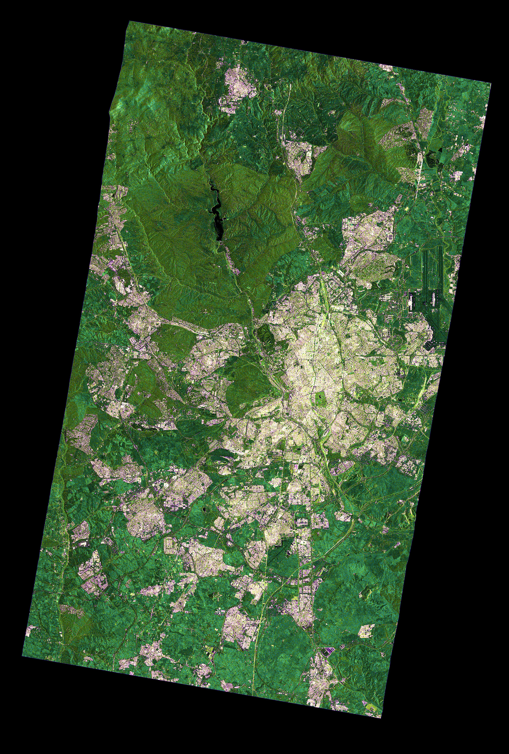
Madrid: TSX Stripmap
TerraSAR-X image of the Madrid region in ‘stripmap mode’ with a resolution of three meters and a width of 30 kilometres. PAZ will deliver the same radar products as TerraSAR-X and TanDEM-X, with resolutions ranging from 18 metres to approximately one metre, regardless of the time of day or cloud cover. Credit: DLR (CC-BY 3.0).
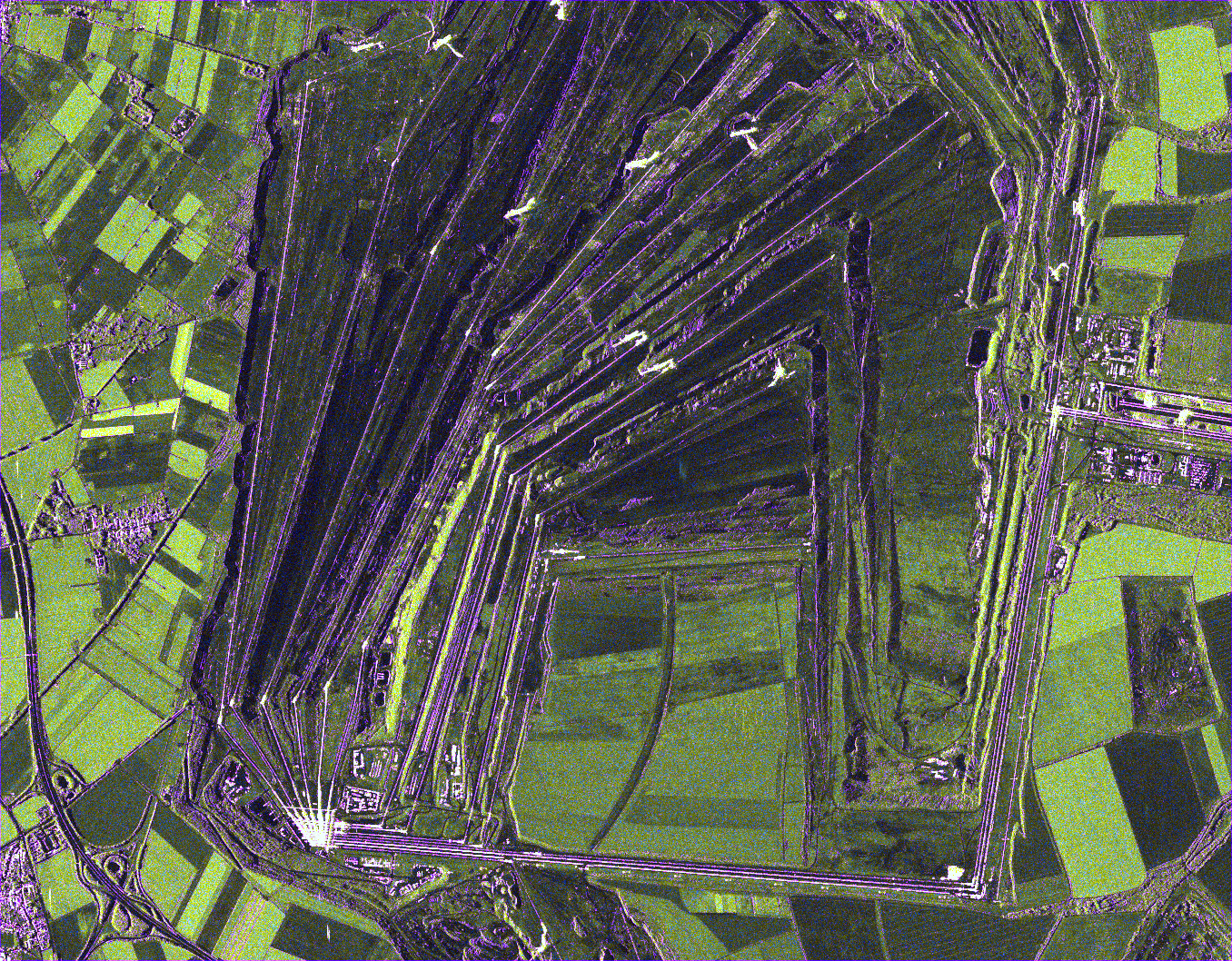
Garzweiler open pit mine: TSX spotlight shot
TerraSAR-X image of the Garzweiler open pit mine in the northern Rhenish lignite mining region: The ‘Spotlight Mode’ enables the depiction of a 10 x 10 kilometre area with a resolution of one metre. The structures of the excavation fields (in purple) stand out clearly in the radar image. The motorway junction Jackerath can be seen Southwest of the open pit. Credit: DLR (CC-BY 3.0).
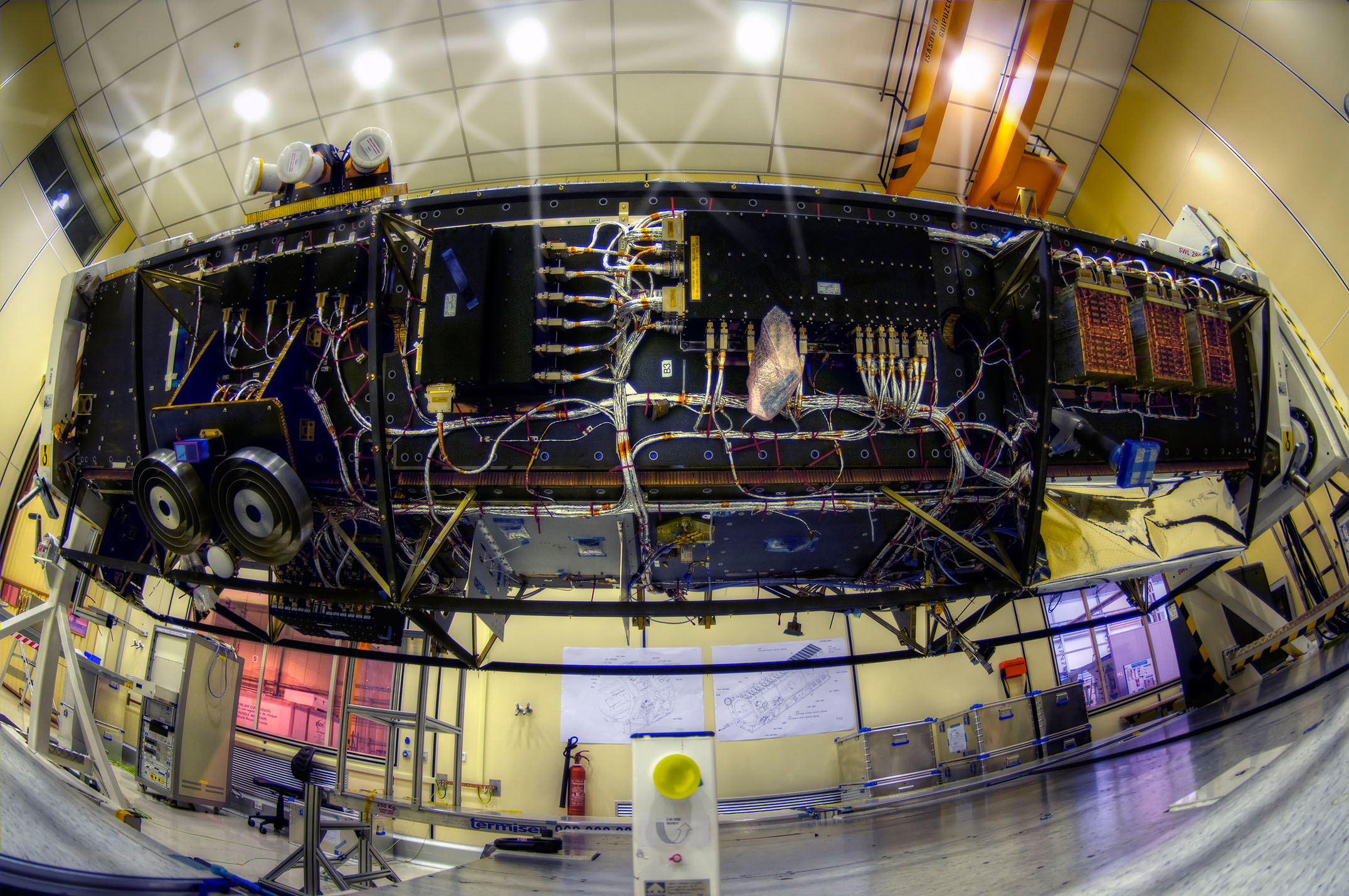
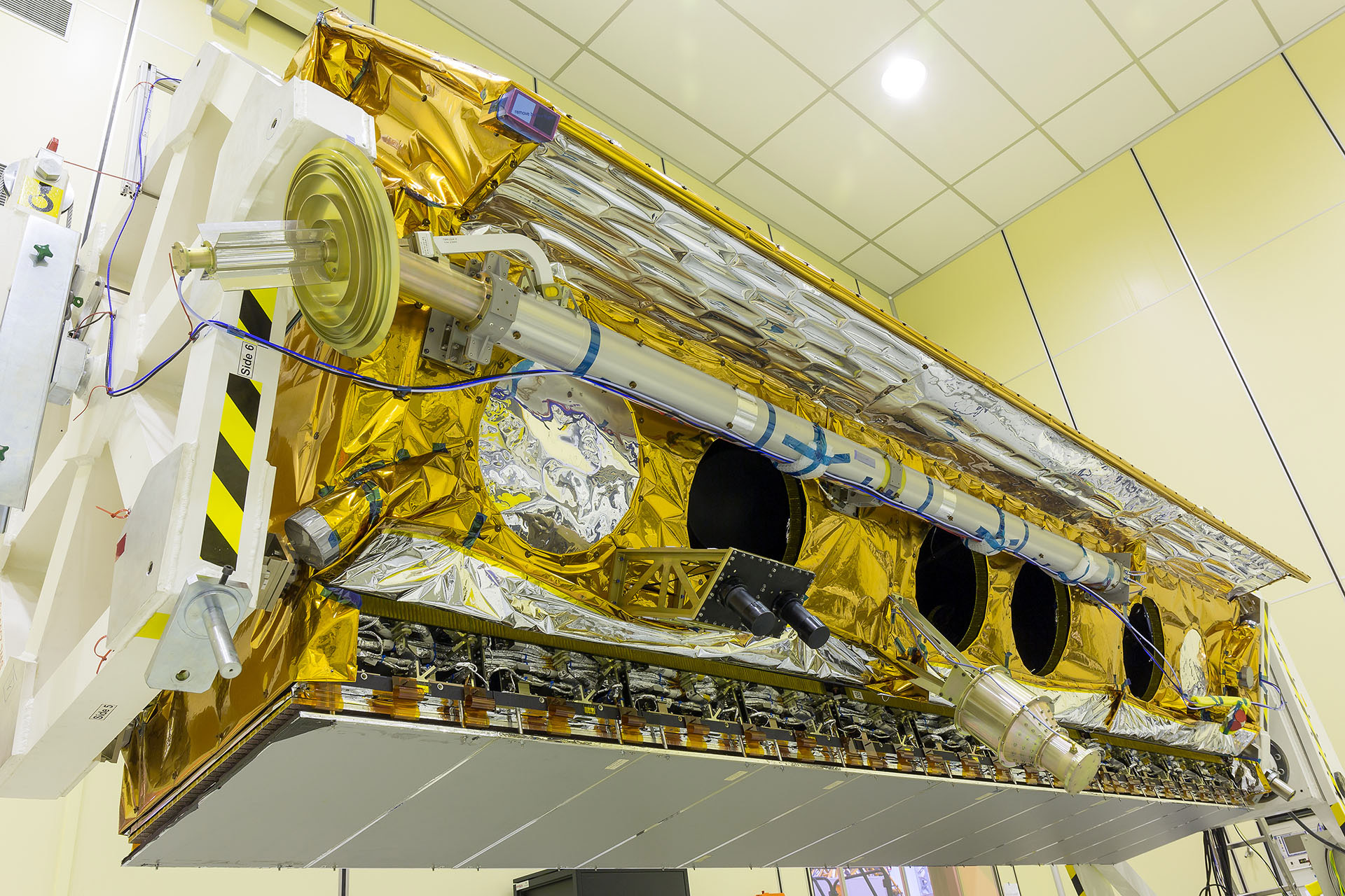
Construction of the radar satellite PAZ
PAZ is owned by the Spanish aerospace company Hisdesat and was built by Airbus Defence and Space in Madrid, Spain. The satellite is five metres long, has a diameter of 2.4 metres and weighs 1400 kilograms. Credit: Hisdesat.
Ready for transport
DLR developed essential elements of the ground segment of PAZ and is responsible for the preparation and implementation of the ‘Launch and Early Orbit Phase’. The Spanish space agency INTA will then take over regular operations. The launch took place from Vandenberg Air Force Base in California, USA. Credit: Hisdesat.
The Spanish Earth observation satellite PAZ was successfully launched on 22 February 2018 at 15:17 CET from Vandenberg Air Force Base in California, United States, on board a Falcon 9 rocket. Interestingly, PAZ is being positioned on the same orbit as the German TerraSAR-X and TanDEM-X radar satellites. In addition, the PAZ ground segment builds on technologies developed by the German Aerospace Center (Deutsches Zentrum für Luft- und Raumfahrt; DLR) for the twin satellites. A constellation of three satellites will make images available faster in the future. PAZ is owned by the Spanish aerospace company Hisdesat and was built by Airbus Defence and Space in Madrid, Spain. Approximately 75 minutes after lift-off, the DLR ground station at Weilheim received the first telemetry data from PAZ, allowing the next phase of the mission to start. During the first five days, DLR's German Space Operations Center (GSOC) will assume control of PAZ and put the satellite through its paces. GSOC will use DLR ground stations in Germany and at the North and South poles to receive data and send commands. Following completion of this Launch and Early Orbit Phase (LEOP), control of the satellite will be handed over to the Spanish space agency (Instituto Nacional de Tecnologia Aeroespacial; INTA), which has been tasked with the construction and operation of the ground segment. Regular operations of PAZ will be run from Torrejón de Ardoz, near Madrid. Ultra-high-resolution images available faster Drawing upon the technology of the TerraSAR-X and TanDEM-X radar satellites, experts at the DLR site in Oberpfaffenhofen have also developed not only the LEOP operation, but also essential elements of the ground segment for regular flight operations. For example, the DLR Microwaves and Radar Institute has developed specialised software for operation and calibration of the radar equipment. The system automatically calculates which commands must be sent to the satellite to ensure that the recorded data is of the highest quality according to user requirements. The radar antenna and recordings are calibrated with the help of special algorithms, so that accurate information can be derived from the data. Finally, for quality control purposes, the software verifies whether the resulting images meet the user requirements and permanently monitors the 'health' of the radar instrument. Another core element of the ground segment is the processor, which generates highly accurate images based on the radar data. The synthetic aperture radar (SAR) processor was developed at the DLR Remote Sensing Technology Institute. PAZ will use it to deliver the same radar products as TerraSAR-X and TanDEM-X, with resolutions ranging from 18 metres to approximately one metre, regardless of the time of day or cloud cover. Together with the two formation flying satellites TerraSAR-X and TanDEM-X, PAZ can record almost any region of Earth's surface within three days. On average, the satellites can capture a location or repeat a recording within 24 hours. They fly over the same point on the ground with exactly the same geometry every 11 days. With PAZ it will be possible to achieve a higher recording capacity and shorter repetition rates in future – recordings will thus be made available more quickly. During the commissioning phase, which will take place during the first few months of the satellite’s life, the developers from Oberpfaffenhofen will be responsible for commissioning the SAR processor, as well as the software for operating and calibrating the instruments. The PAZ mission is planned to last five and a half years. Designed as a dual-use satellite, it addresses both commercial and government requirements, particularly in terms of civil surveillance tasks and defence and security applications. Hisdesat will use the constellation in conjunction with Airbus Defence and Space. The future Tandem-L mission With TerraSAR-X and TanDEM-X, Germany has achieved globally recognised expertise and a unique selling point over decades. To maintain this leadership role in the future, DLR researchers are already working on Tandem-L, a proposal for a highly innovative radar mission for environmental observation and climate research. The imaging technology of the Tandem-L satellite will set new standards in Earth observation and thus make an effective contribution to addressing major societal challenges – both nationally and internationally. The research policy evaluation of the mission proposal is currently taking place. The decision regarding the realisation of Tandem-L is expected in mid-2018. |
| URL | 查看原文 |
| 来源平台 | German Aerosapce Center |
| 文献类型 | 新闻 |
| 条目标识符 | http://119.78.100.173/C666/handle/2XK7JSWQ/106864 |
| 专题 | 地球科学 |
| 推荐引用方式 GB/T 7714 | admin. PAZ Earth observation satellite successfully launched. 2018. |
| 条目包含的文件 | 条目无相关文件。 | |||||
| 个性服务 |
| 推荐该条目 |
| 保存到收藏夹 |
| 查看访问统计 |
| 导出为Endnote文件 |
| 谷歌学术 |
| 谷歌学术中相似的文章 |
| [admin]的文章 |
| 百度学术 |
| 百度学术中相似的文章 |
| [admin]的文章 |
| 必应学术 |
| 必应学术中相似的文章 |
| [admin]的文章 |
| 相关权益政策 |
| 暂无数据 |
| 收藏/分享 |
除非特别说明,本系统中所有内容都受版权保护,并保留所有权利。


修改评论