


Global S&T Development Trend Analysis Platform of Resources and Environment
| Multibeam technology helping Australian scientists understand the seafloor | |
| admin | |
| 2018-12-05 | |
| 发布年 | 2018 |
| 语种 | 英语 |
| 国家 | 澳大利亚 |
| 领域 | 资源环境 |
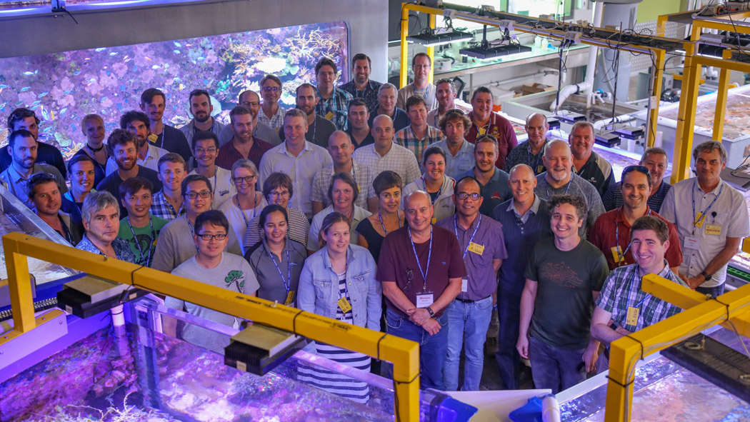
| 正文(英文) | AIMS has welcomed 60 international delegates including marine biologists, ecologists, oceanographers, geologists, geophysicists, fisheries scientists and data analysts to the 76th Multibeam Sonar Training course at Townsville headquarters. Lead scientist for Acoustic Imaging Nicole Bergersen and Emeritus Professor Dave Wells and his team of international experts from the University of New Brunswick and University of New Hampshire came to AIMS for a week of intensive study on all aspects of swath mapping technology. “Swath mapping and ocean acoustic technology compliments and expands the excellent research already being conducted by AIMS scientists,” Ms Bergersen said. “Better understanding of regional geology and geography through acoustic techniques is essential for marine ecological studies and change recognition. She said attendees would use what they have learned to contribute to offshore engineering, charting the seafloor, continental shelf boundary delimitation, healthier harbour dredging, studying marine life habitats, planning underwater infrastructure and many other fields of ocean related research.
AIMS Data Manager Mark Case said the training provided a key link to AIMS research efforts. In 2017, Acoustic Imaging partnered with AIMS to upgrade the multibeam capabilities of the Western Australian-based Research Vessel Solander. “The RV Solander is equipped with the latest in multibeam technology,” he said. “It is allowing our researchers to map and classify the sea floor in detail, improving our habitat mapping when combined with our biological data. This improves our environmental risk assessments particularly in deep water survey areas.” What is multibeam?A multibeam echosounder is a tool that uses sonar to produce a three dimensional map of the sea floor. It is used for a range of applications from assessing depth through to constructing habitat maps and spatial models. Multibeam is able to map deeper coral reef systems on shoals which are beyond diving depth and not visible using satellite imagery of aerial photography. AIMS uses the technology aboard the RV Solander to discover and document coral reefs shoals, primarily on the North West Shelf of Australia. 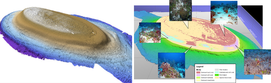
|
| URL | 查看原文 |
| 来源平台 | Australian Institute of Marine Science |
| 文献类型 | 新闻 |
| 条目标识符 | http://119.78.100.173/C666/handle/2XK7JSWQ/233017 |
| 专题 | 资源环境科学 |
| 推荐引用方式 GB/T 7714 | admin. Multibeam technology helping Australian scientists understand the seafloor. 2018. |
| 条目包含的文件 | 条目无相关文件。 | |||||
| 个性服务 |
| 推荐该条目 |
| 保存到收藏夹 |
| 查看访问统计 |
| 导出为Endnote文件 |
| 谷歌学术 |
| 谷歌学术中相似的文章 |
| [admin]的文章 |
| 百度学术 |
| 百度学术中相似的文章 |
| [admin]的文章 |
| 必应学术 |
| 必应学术中相似的文章 |
| [admin]的文章 |
| 相关权益政策 |
| 暂无数据 |
| 收藏/分享 |
除非特别说明,本系统中所有内容都受版权保护,并保留所有权利。
修改评论