Global S&T Development Trend Analysis Platform of Resources and Environment
| NASA Satellite Begins Orbit to Record Changes in Sea Level | |
| admin | |
| 2020-12-07 | |
| 发布年 | 2020 |
| 语种 | 英语 |
| 国家 | 美国 |
| 领域 | 资源环境 |
| 正文(英文) | 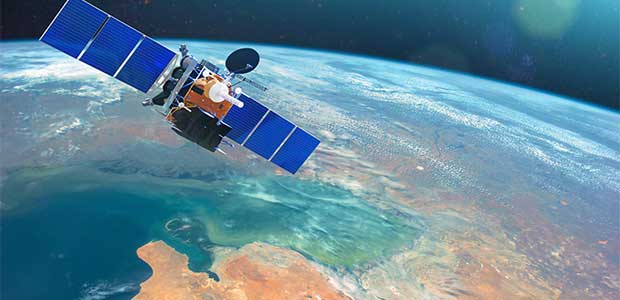
NASA’s Sentinel 6-Michael Freilich satellite will monitor changes in sea level for the next ten years. NASA launched the first of two satellites designed to monitor the rise in sea level over the next decade on November 21, reports USA Today. The Sentinel 6-Michael Freilich oceanography satellite will use positioning systems to measure changes in sea level that can be attributed to climate change. Data on atmospheric temperature and humidity will also be collected to help better weather forecasts and climate models. “This thing has a radar that tells us how far away the satellite is from the ocean’s surface, so it bounces off and measures the return time,” said NASA project scientist Josh Willis. “And then it also has a bunch of positioning systems. So if you know where the satellite is, and you know how far away it is from the water, then you can use both of those pieces of information to tell you how tall the ocean is.” Experts expect sea level to continue rising at increasing speeds in the years to come. The Sentinel satellite will document these changes “down to the centimeter for 90% of the world’s oceans,” says NASA. |
| URL | 查看原文 |
| 来源平台 | Environmental Protection |
| 文献类型 | 新闻 |
| 条目标识符 | http://119.78.100.173/C666/handle/2XK7JSWQ/306475 |
| 专题 | 资源环境科学 |
| 推荐引用方式 GB/T 7714 | admin. NASA Satellite Begins Orbit to Record Changes in Sea Level. 2020. |
| 条目包含的文件 | 条目无相关文件。 | |||||
| 个性服务 |
| 推荐该条目 |
| 保存到收藏夹 |
| 查看访问统计 |
| 导出为Endnote文件 |
| 谷歌学术 |
| 谷歌学术中相似的文章 |
| [admin]的文章 |
| 百度学术 |
| 百度学术中相似的文章 |
| [admin]的文章 |
| 必应学术 |
| 必应学术中相似的文章 |
| [admin]的文章 |
| 相关权益政策 |
| 暂无数据 |
| 收藏/分享 |
除非特别说明,本系统中所有内容都受版权保护,并保留所有权利。


修改评论