


When large waves reach the mouth of a coastal estuary, they can move enough sediment to build up a sand bar — otherwise known as a sill — at the mouth. Without rain and river flows to wash the sill away, this sill can block the estuary mouth and cause it to close, separating it from the open ocean. Estuaries that close in this way, termed intermittently closed estuaries, include Los Peñasquitos Lagoon in San Diego County and Malibu Lagoon in Los Angeles County, amongst many others in California and similar climates worldwide.
The project, funded in part by California Sea Grant and USC Sea Grant, focused on how different estuaries responded to the El Niño storms, particularly the differences in response between the intermittently closed estuaries versus estuaries that are structurally modified to stay open, known as perennially open estuaries.

The study found that intermittently closed estuaries are more likely to close and experience high water levels as a result of extreme events, compared to estuaries that typically remain open.
“Comparing the response of multiple estuaries within a geographic area to the same oceanographic and riverine forcing is unique,” said Harvey. “And we see that the two different estuary types, intermittently closed and perennially open, fall into two very different response regimes.”
Harvey and her colleagues found that within the perennially open estuaries, such as San Diego Bay, water levels within the estuary mimicked water levels offshore during storms. However, the responses of intermittently closed estuaries, such as the Malibu and Santa Margarita estuary systems, were more complex. In 2015-2016, these intermittently closed estuaries closed more often than during a typical year, because of larger than usual winter waves that built sills at the estuary mouths. These closures resulted in even higher water levels within these systems than offshore.

Southern California estuaries which normally close for short periods remained closed for longer periods of time during the El Niño season than during a normal winter. This could mean that if there are larger waves in the future, more frequent and longer estuary mouth closures can be expected.
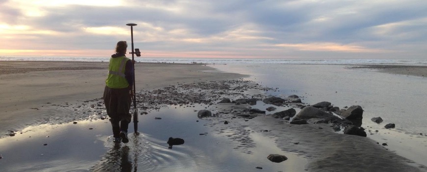
The study revealed that the height of these inlet-closing sand sills is correlated to low tide water level measurements within the estuary. Sill height, combined with rainfall and wave predictions, can help predict mouth closures. This means that estuary managers may be able to monitor these water levels to improve closure predictions and develop actionable management responses. This is good news for managers — water levels are an easy thing for them to measure and the cost is relatively low.
Knowing that the two estuary types can respond so differently to the same conditions can help Southern California to develop two different management scenarios — rather than putting all estuaries into one box. This study highlights that distinction and emphasizes the vulnerability of intermittently closed estuaries to sea-level rise and larger wave heights in the future.
In addition to Madeleine Harvey, this study was co-authored by researchers from Scripps Institution of Oceanography, the Southern California Coastal Water Research Project, Tijuana River National Estuarine Research Reserve, California State University Long Beach, the University of California Los Angeles, the University of California Davis Bodega Bay, Florida Atlantic University, UC San Diego, USGS, The Bay Foundation, the University of California Los Angeles, the University of California Santa Barbara, and Coastal Environments.
Funding for this project was provided in part by California Sea Grant with the Southern California Coastal Water Research Project (SCCWRP) and USC Sea Grant with Scripps Oceanography, California Department of Parks and Recreation Division of Boating and Waterways Oceanography Program, California Coastal Conservancy, NOAA, Los Peñasquitos Lagoon Foundation, and a Blasker Environment Grant from the San Diego Foundation to Scripps Oceanography.
Funding for Seal Beach, Mugu Lagoon, and Newport Bay data collection was provided by the Department of the Interior Southwest Climate Adaptation Science Center and the United States Geological Survey, Western Ecological Research Center. This work was also supported by two traineeships through USC Sea Grant and The National Oceanic and Atmospheric Association Ernest F. Hollings Undergraduate Scholarship.
-- Sky Smith
修改评论